My travels during 2011
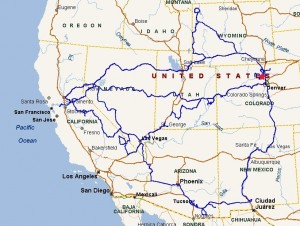
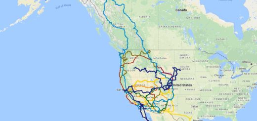
In Jan 2011 I began the first road trip of the year from the SF Bay Area over the Sierra mountains and began heading South into Arizona where I stayed for a month before and passing through New Mexico and turning Northward in Feb. I stayed in Colorado while Tim finished his school year.
In June, Tim and I have begun a 2000 mile trip from Colorado, through Grand Teton, Yellowstone, and Glacier National Parks. However, weather prevented us from accomplishing the entire trip so Glacier will have to wait for another time. Soon after we were back on the road heading into California for 3 weeks where we visited my family and Yosemite National Park before returning back to Colorado.
In September, I alone rolled back into California before the winter set it to hang out with family for the month. In early October I set back out towards Colorado detouring South-east into Yosemite, Mono Lake, Death Valley, and then turned North-East to Zion National Park, Bryce Canyon National Park & Capitol Reef National Park before heading home.
- Rhyolite, NV (ghost town)
- Amargosa Opera House, NV
- Death Valley Ntnl Park
- Tombstone, AZ
- Saguaro National Park
- Pima Air Museum, AZ
- San Pedro House & Trail, AZ
- Chiricahua National Monument, AZ
- Petroglyph Ntnl Monument, NM
- Teton Forest, WY
- Grand Teton Ntnl Park, WY
- Yellowstone Ntnl Park, WY
- Fossil Butte Ntnl Monument, WY
- Peaceful Valley campground, CO
- Yosemite Ntnl Park, CA
- Black Chasm Ntnl Landmark, CA
- Rocky Mtn Ntnl Park, CO (Kawunecche Valley)
- Wildlife Sanctuary, CO
- Colorado Ntnl Monument, CO
- Arches Ntnl Park, UT – Delicate Arch hike
- Negro Bill Canyon -, Moab, UT
- Pipi Valley, CA
- Yosemite Ntnl Park
- Mono Lake, CA
- Panum Valcano Crater
- Keough’s Hot Springs, CA
- Manzanar War Relocation Center
- Diaz Lake Recreation Area
- Death Valley Ntnl Park (drive-thru only)
- Valley of Fire State Park, NV
- Zion National Park, UT – Angel’s Landing, Taylor Creek
- Bryce Canyon National Park, UT

LilNomad future fulltime RV’er here..wondering how you are supporting yourself on the road.
Thanks
LilNomad
I guess I am one of the lucky ones. I own my own business, of which the work is all online. So as long as I have an Internet connection, which is a daily requirement for me, I can do my work and pay myself each month.